

Our Services

GEOPHYSICAL INVESTIGATION

Our Geophysical Division provides non-destructive subsurface investigations to define soil, rock, and groundwater conditions. These surveys support foundation design, geotechnical studies, and environmental assessments by providing detailed profiles of the subsurface without drilling.

SURFACE GEOPHYSICS

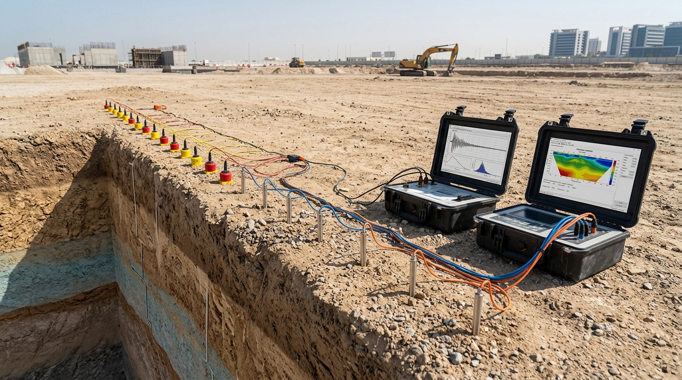
  • Multi-Channel Analysis of Surface Waves (MASW): Determines the shear-wave velocity (Vs) profile of the subsurface for seismic site classification and foundation design.
  • Electrical Resistivity Tomography (ERT): Maps subsurface resistivity variations to identify soil stratification, groundwater levels, and possible voids or contamination zones.

BOREHOLE GEOPHYSICS

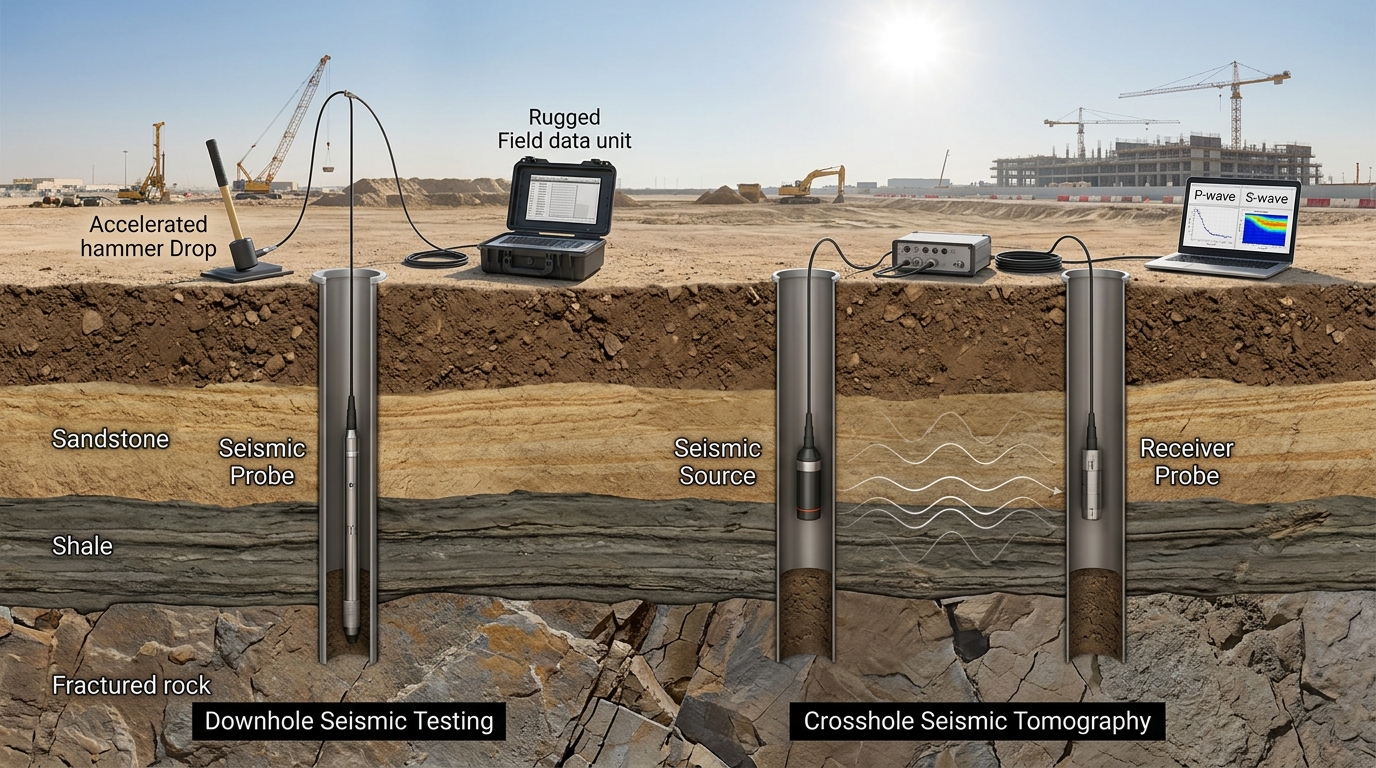
  • Downhole Seismic Testing: Measures in-situ P- and S-wave velocities at different depths to determine dynamic soil properties and stiffness profiles.
  • Crosshole Seismic Tomography: Provides high-resolution velocity mapping between boreholes, offering precise subsurface continuity and layer characterization.
Our Services

Surface Geophysics

  • Multi-Channel Analysis of Surface Waves (MASW): Determines the shear-wave velocity (Vs) profile of the subsurface for seismic site classification and foundation design.
  • Electrical Resistivity Tomography (ERT): Maps subsurface resistivity variations to identify soil stratification, groundwater levels, and possible voids or contamination zones.

Borehole Geophysics

  • Downhole Seismic Testing: Measures in-situ P- and S-wave velocities at different depths to determine dynamic soil properties and stiffness profiles.
  • Crosshole Seismic Tomography: Provides high-resolution velocity mapping between boreholes, offering precise subsurface continuity and layer characterization.